Property Record
401 Parris Island Gtwy, Beaufort, SC 29906
NEARBY LISTINGS FOR SALE OR LEASE
Property Detail
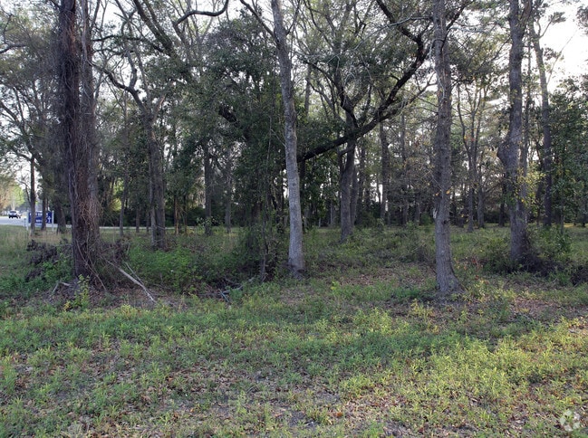
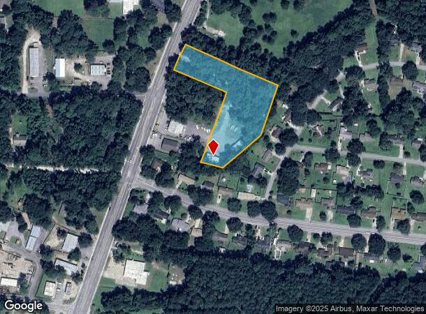
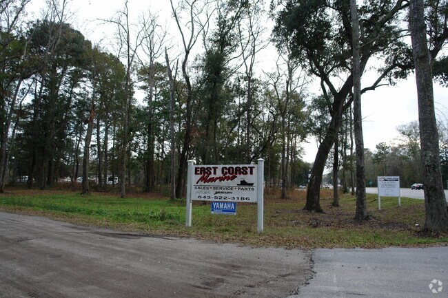
401 Parris Island Gtwy
Hilton Head Island-Bluffton-Beaufort, SC
Shell Point Commercial
R100-031-000-0160-0000
POR OF PORT ROYAL ISL REVISED PLAT PB51 P173 *2/96 0.60 AC DEDUCTED 31/104C 3/00
Autorepair
Beaufort
2025
South Carolina
2024
2.92 AC
000503
Hilton Head/Beaufort
930 SF
Other Market Areas
DEMOGRAPHICS near 401 Parris Island Gtwy
1 Mile
3 Mile
5 Mile
2024 Total Population
2,420
25,110
40,502
2029 Population
2,684
27,885
44,680
Pop Growth 2024-2029
+ 10.91%
+ 11.05%
+ 10.32%
Average Age
38
38
37
2024 Total Households
925
10,235
14,970
HH Growth 2024-2029
+ 10.59%
+ 10.59%
+ 10.59%
Median Household Inc
$66,909
$59,772
$57,465
Avg Household Size
2.60
2.40
2.40
2024 Avg HH Vehicles
2.00
2.00
2.00
Median Home Value
$264,034
$243,844
$259,620
Median Year Built
2000
1992
1991
Nearby Places
Map Layers
Map Styles
 Street
 Aerial
- Restaurants
- Banks
- Shops
- Fitness
- Groceries
PUBLIC TRANSPORTATION
AIRPORT
Hilton Head
DRIVE
WALK
Distance
Hilton Head
48 min
34.2 mi
Freight Ports
Georgia Ports - Savannah
DRIVE
WALK
Distance
Georgia Ports - Savannah
57 min
43.6 mi
Nearby Properties
Address
Land Use
TOTAL SIZE
Lot Size
Zoning
Address
Land Use
TOTAL SIZE
Lot Size
Zoning
8,358 SF
21.89 AC
6611
Address
Land Use
TOTAL SIZE
Lot Size
Zoning
245,864 SF
19.36 AC
6601
Address
Land Use
TOTAL SIZE
Lot Size
Zoning
243,644 SF
13.23 AC
6601
Address
Land Use
TOTAL SIZE
Lot Size
Zoning
426,516 SF
32.63 AC
6601
Address
Land Use
TOTAL SIZE
Lot Size
Zoning
1,802 SF
21.42 AC
6111
Address
Land Use
TOTAL SIZE
Lot Size
Zoning
22,944 SF
16.59 AC
6101
Address
Land Use
TOTAL SIZE
Lot Size
Zoning
23,136 SF
9.67 AC
6101
Address
Land Use
TOTAL SIZE
Lot Size
Zoning
217,792 SF
60 AC
6611
Address
Land Use
TOTAL SIZE
Lot Size
Zoning
103,282 SF
19.22 AC
Address
Land Use
TOTAL SIZE
Lot Size
Zoning
85,656 SF
22.54 AC
6611
Address
Land Use
TOTAL SIZE
Lot Size
Zoning
24,024 SF
20.45 AC
6611
Address
Land Use
TOTAL SIZE
Lot Size
Zoning
142,753 SF
47.79 AC
6611
Address
Land Use
TOTAL SIZE
Lot Size
Zoning
116,067 SF
27 AC
6611
Address
Land Use
TOTAL SIZE
Lot Size
Zoning
214,795 SF
24.94 AC
6611
Address
Land Use
TOTAL SIZE
Lot Size
Zoning
4,928 SF
4.76 AC
6611
Address
Land Use
TOTAL SIZE
Lot Size
Zoning
60,440 SF
9.28 AC
6611
Address
Land Use
TOTAL SIZE
Lot Size
Zoning
50,800 SF
4.03 AC
6611
Address
Land Use
TOTAL SIZE
Lot Size
Zoning
60,814 SF
3 AC
Address
Land Use
TOTAL SIZE
Lot Size
Zoning
37,624 SF
2.42 AC
6611
Address
Land Use
TOTAL SIZE
Lot Size
Zoning
6,024 SF
10.60 AC
6611
Address
Land Use
TOTAL SIZE
Lot Size
Zoning
92,125 SF
10.14 AC
6611
Address
Land Use
TOTAL SIZE
Lot Size
Zoning
134,446 SF
19.90 AC
6611
Address
Land Use
TOTAL SIZE
Lot Size
Zoning
67,773 SF
20.19 AC
6611
Address
Land Use
TOTAL SIZE
Lot Size
Zoning
6,784 SF
10.50 AC
6111
Address
Land Use
TOTAL SIZE
Lot Size
Zoning
53,684 SF
24.30 AC
6611
Address
Land Use
TOTAL SIZE
Lot Size
Zoning
44,312 SF
1.87 AC
Address
Land Use
TOTAL SIZE
Lot Size
Zoning
52,322 SF
6.86 AC
6601
Address
Land Use
TOTAL SIZE
Lot Size
Zoning
53,704 SF
4.76 AC
6611
Address
Land Use
TOTAL SIZE
Lot Size
Zoning
36,020 SF
3.46 AC
6611
The World's #1 Commercial Real Estate Marketplace
Connect with us
© 2025 CoStar Group
The information above has been obtained from sources believed reliable. While we do not doubt its accuracy we have not verified it and make no guarantee, warranty or representation about it. It is your responsibility to independently confirm its accuracy and completeness. Any projections, opinions, assumptions, or estimates used are for example only and do not represent the current or future performance of the property. The value of this transaction to you depends on tax and other factors which should be evaluated by your tax, financial, and legal advisors. You and your advisors should conduct a careful, independent investigation of the property to determine to your satisfaction the suitability of the property for your needs.